Maps
Currently, the best way to see how the planets lay relative to one
another is by using Claus Bornich's program "It's Full of
Stars". This program is a freeware starmapping program. Written in
1998, it's a bit of an old warhorse but it has nice features for
the price. You can get it
here. You can find the IFOS map used to generate these
images here.
IFOS seems to have disappeared from the net... try
this download
to use it... I make no guarantees.Eventually, I'm intending to use the phenomenal Blender and its
ever-so-handy game engine to create a flyable galactic map. Until then,
it's IFOS or these images. Custom charts can be generated on request.
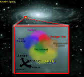 |
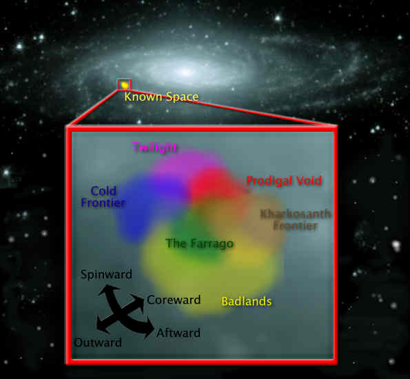
Approximate galactic position of the known powers. |
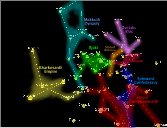 |
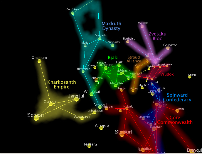
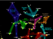
An overview of the layout of the major galactic
powers. |
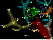 |
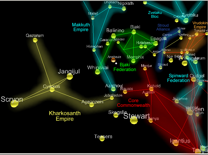
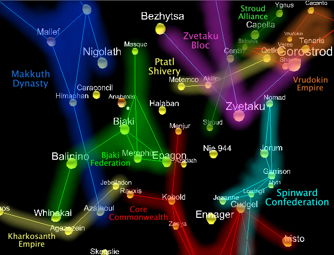
A nice view of the edge of the Universe, where the
Kharkosanth Empire stretches away from the Makkuth Dynasty, Bjaki
Federation, and Core Commonwealth. |
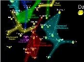 |
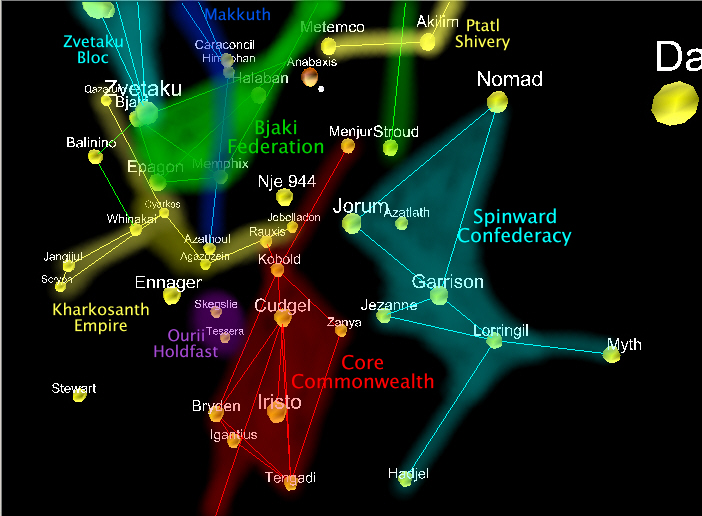
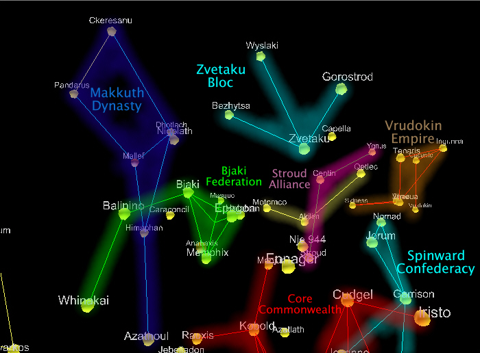
A view from behind/spinward. Good view of the
Spinward Confederacy, Core Commonwealth, Kharkosanth Empire, Bjaki
Federation, and Ptatl Shivery. |
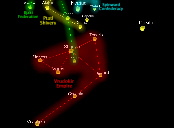 |
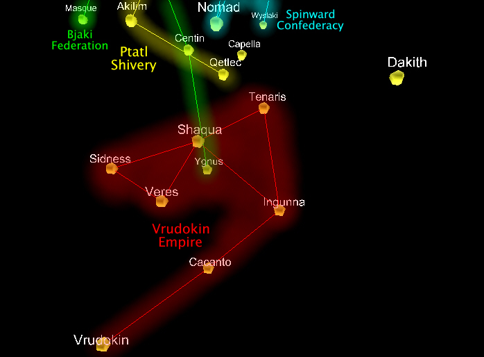
Remotely located in Bloc 6, the Vrudokin Empire is
just starting to run into the other major powers pictured. |
 |
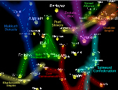
"Top" of a three-part overview of
the major powers. |
 |
"Middle" of a three-part overview of
the major powers. |
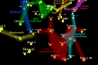 |
"Bottom" of a three-part overview of
the major powers. |
|